Damaging Winds Warning for Fleurieu and KI

Staff Reporters
26 August 2024, 7:53 AM
 The Bureau of Meteorology has issued a Severe Weather Warning
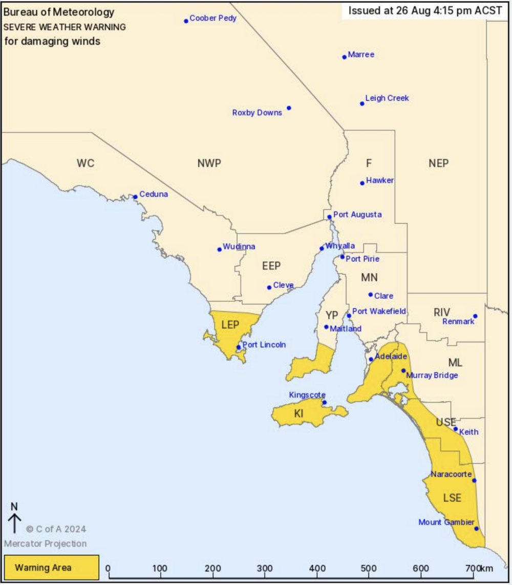
The Bureau of Meteorology has issued a Severe Weather Warning for residents in the Mount Lofty Ranges, including the Fleurieu Peninsula and Kangaroo Island, with damaging winds expected to hit the region from Tuesday afternoon.
Weather Overview: A strong cold front is approaching the southwest coast, with powerful northwesterly winds anticipated ahead of its arrival. As the front moves across Eyre and Yorke Peninsulas on Tuesday afternoon, the winds will shift to westerly, impacting the Fleurieu Peninsula and Kangaroo Island by the evening.
What to Expect:
- Wind Speeds: Winds averaging 60-70 km/h with peak gusts around 90 km/h.
- Timing: Damaging winds are expected to develop on Tuesday evening and could persist into Wednesday afternoon.
- Affected Areas: Key locations in our region include Kingscote and other parts of Kangaroo Island, along with communities across the Fleurieu Peninsula.
Safety Recommendations:
- Secure Property: Ensure all loose items around your property are secured or moved indoors.
- Protect Vehicles: Park vehicles under cover or away from large trees.
- Stay Indoors: Remain inside and away from windows during the peak of the storm.
For storm preparation tips, visit the SA State Emergency Service. If you need assistance during the storm, contact SES at 132 500. In life-threatening situations, call Triple Zero (000) immediately.
Stay safe and be prepared as this weather system moves through our region.
For more updates, follow local weather reports and stay informed as conditions develop.