Footprints – Ravine Hike Ravine des Casoars, Kangaroo Island
Staff Reporters
15 June 2024, 8:30 PM

SPOTLIGHT STORY
Words & Photos: Susie Williams
This Kangaroo Island hike starts from the Ravine des Casoars Road, just 7 km south of the Playford Highway near Cape Borda Lighthouse, and promises an enchanting adventure in the northwestern expanse of the island.
The trail unfolds along the ravine valley towards the coast, meandering past the creek bank and offering breathtaking vistas from elevated vantage points. It is a journey infused with historical intrigue, as in 1802 French explorer Nicolas Baudin encountered what he mistakenly identified as Cassowaries, but were actually Kangaroo Island Emus, sadly now extinct.
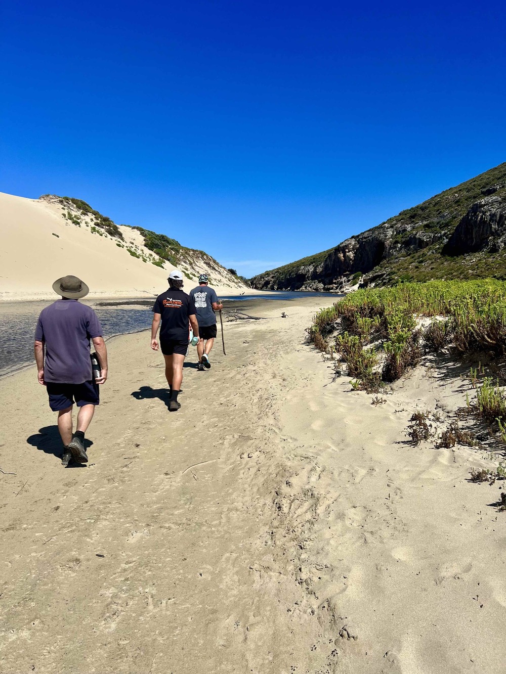
Setting out with a group of four, we walked the mostly corrugated track from Cape Borda, greeted by the melodious calls of Currawongs on reaching the car park. Energised by the promise of discovery, we began the Ravine hike on a balmy summer morning.
The path, clearly marked and moderately challenging, winds through rocky terrain, allowing us to marvel at the regenerative prowess of nature following the 2020 summer fires. The resilience of the landscape is evident as young gum trees flourish alongside their charred predecessors, a poignant testament to nature's ability to rebound.
As we advanced glimpses of the valley below unfolded, which had previously been concealed before the ravages of the fire. Our journey was serenaded by unseen birds chirping, punctuated by the occasional appearance of charming superb blue fairy wrens and a rhythmic chorus of cicadas.
Halfway into our hike, we encountered a shallow creek, its smooth rocks forming a picturesque border, where a solitary shag indulged in a leisurely swim. Amidst the eucalyptus forest, the subtle crackling of seed pods bursting open showcased nature's ingenious dispersal mechanisms.
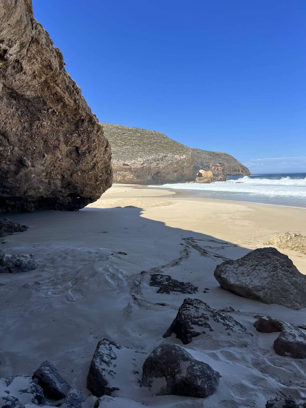
Gradually, the dense eucalyptus canopy yielded to coastal vegetation as we approached the shoreline. Sandy paths replaced rocky terrain, leading us to a spacious beach where the creek met the sea. Crossing the stream, we encountered soft, squeaky sand, flanked by towering cliff faces pocked with mysterious caves.
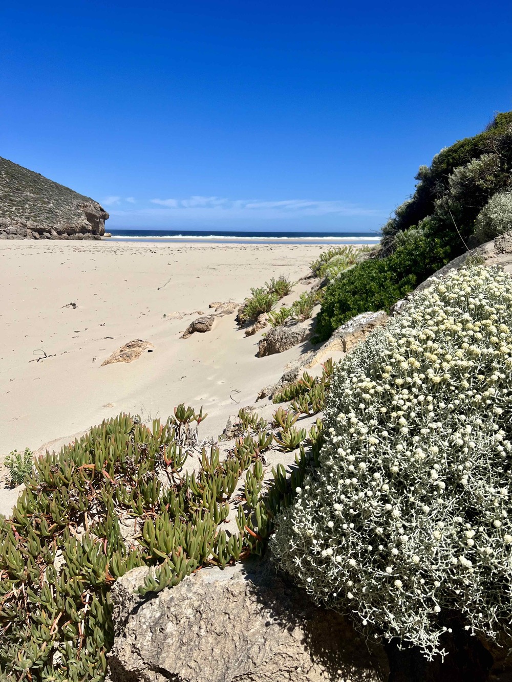
The roar of the ocean served as our ultimate reward, accompanied by the spectacle of crashing waves. We spent an hour exploring the beach and its adjacent caves, discovering penguin footprints and marvelling at the raw beauty of the coastline.
Our return journey, hastened by the rising temperature, offered a different perspective of the landscape. Pausing only to admire a monitor lizard seeking respite from the heat, we made our way back to the car, eager for the comfort of air conditioning.
For future adventurers, we recommend allocating approximately three hours for the hike, allowing ample time to soak in the scenery and unwind at the beach.
En route back to the road, a sign directs towards the Scott Cove lookout, offering a stunning panorama of the northern coastline and the Fides Bluff Marine Park, a reminder of the maritime history of Kangaroo Island. This is the final resting place of the ship ‘Fides’, which departed London on its final voyage from London on 11 January 1860 bound for Port Adelaide. In the early hours of May 22 heavy seas pounded the ship and within hours it had broken up. Five crew reached the shore and, after an arduous trek along the cliffs and through dense scrub, the survivors arrived at Cape Borda Lighthouse.
Our final stop at Harvey's Return Cemetery paid homage to the pioneers of Cape Borda Lighthouse, set within the rugged landscape since 1858. As we bid farewell to this enchanting corner of Kangaroo Island, we carried with us memories of nature's resilience and the timeless allure of its coastal vistas.
Story kindly funded through LINA (Local Independent News Association)