More damaging winds on the way

Fleurieu App
19 November 2022, 11:47 PM

Locally damaging wind gusts are expected across the southern parts of the state today and tomorrow.
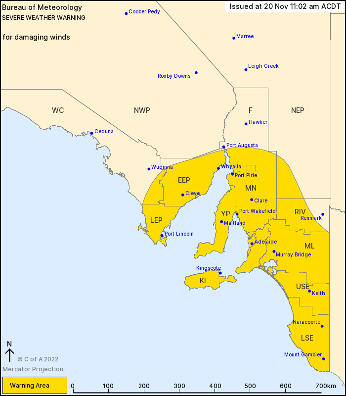
The Australian Government Bureau of Meteorology has issued a severe weather warning for damaging winds.
Windy on Sunday and Monday over parts of central and southeast South Australia.
A vigorous west to southwesterly airstream with a number of embedded cold fronts will affect central and southeast South Australia today and Monday.
For SUNDAY:
Westerly winds averaging 40 to 60 km/h with DAMAGING GUSTS up to 100 km/h are possible over the warning area including Adelaide. The risk is highest near the coast and over the Mount Lofty ranges. Squally showers and thunderstorms are also possible with locally damaging gusts. Winds should ease below warning thresholds inland during the evening, although the risk persists along the coast overnight.
For MONDAY:
The strongest of the fronts result in widespread windy conditions across central and southeast parts of the State from the morning.
DAMAGING WEST to SOUTHWESTERLY WINDS averaging 50 to 70 km/h with peak gusts to 100 km/h are likely along much of the Southeast coasts and also across the Mount Lofty ranges.
For the remainder of the warning area including Adelaide, squally conditions will develop during the day with DAMAGING GUSTS up to 100 km/h, especially with showers or thunderstorms.
Kingscote is amongst the locations which may be affected. Also include are Adelaide, Port Lincoln, Whyalla, Mount Gambier and Naracoorte.
The State Emergency Service advises that people should:
* Move vehicles under cover or away from trees;
* Secure or put away loose items around your property.
* Stay indoors, away from windows, while conditions are severe.