Severe weather warning for Fleurieu and KI tonight

Fleurieu App
04 June 2022, 7:32 AM
 Severe warning for tonight
The Bureau of Meterology has released a severe weather warning for damaging winds for the Fleurieu and Kangaroo Island and other areas of the state.
Issued at 4:50 pm Saturday, 4 June 2022.
Damaging wind gusts expected to develop Saturday evening and overnight.
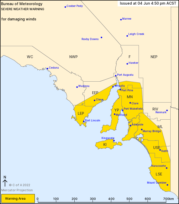
Weather Situation: A deep low situated west of Tasmania extends a vigorous cold front across southern SA during Saturday evening and overnight.
Strong northwest to westerly winds averaging 50 to 60 km/h with DAMAGING WIND GUSTS in excess of 90 km/h, are possible ahead of and with the cold front on Saturday evening and overnight.
There is a small chance of locally DESTRUCTIVE WINDS with peak gusts in excess of 125 km/h associated with isolated tornadoes over the southern parts of the Fleurieu Peninsula, Kangaroo Island, and southern coastal parts, this evening.
Damaging wind gusts are expected to ease over low lying areas early Sunday morning, but may continue about Mount Lofty Ranges and southern Flinders Ranges through Sunday.
Locations which may be affected include Adelaide, Port Lincoln, Whyalla, Mount Gambier, Kingscote and Naracoorte.
The State Emergency Service advises that people should:
* Move vehicles under cover or away from trees;
* Secure or put away loose items around your property.
* Stay indoors, away from windows, while conditions are severe.
Warnings are also available through TV and Radio broadcasts, the Bureau's website