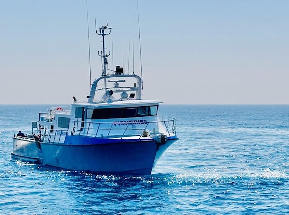
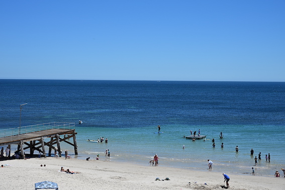
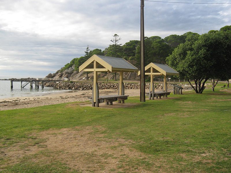
The Fleurieu App

News


Increased access to AEDs across KI

15 January 2026, 8:19 PM

Kangaroo Island Council has supported improved access to lifesaving equipment across the Island, with 23 new Automated External Defibrillators (AEDs) installed at publicly accessible locations in late 2025, ahead of new AED legislation that came into effect on 1 January 2026.The new AEDs have been installed at a range of locations including campgrounds, boat ramps, sporting venues and community spaces, helping ensure residents and visitors can access emergency equipment when it is most needed.Ten of the new AEDs were partly funded through the South Australian Government AED Grant Program, which provided up to $1,000 per device.Under the new legislation, AED requirements are determined by specific criteria, including the type of facility, how it is used, expected numbers of people and whether the location is publicly accessible. The legislation does not require an AED at every individual site, but instead focuses on placing devices where they are most likely to be needed and accessed quickly in an emergency.Kangaroo Island Council says it assessed its own facilities against these criteria, with a particular focus on higher-use public locations and areas where emergency response times may be longer due to distance or remoteness. This approach supports compliance with the legislation while improving practical, Island-wide access to AEDs.There are now approximately 40 AEDs located in publicly accessible areas across Kangaroo Island, including devices installed by the council and other facility operators. Many of these AEDs are registered on the GoodSAM AED Registry, which is linked to Triple Zero (000).In a medical emergency, the public should always call 000 first, where operators can provide assistance and direct callers to the nearest registered AED.Mayor Michael Pengilly says the focus is on ensuring people know AEDs are available and how to access them in an emergency.“This is about awareness and access,” he says.“If an AED is needed, calling 000 straight away is critical. Emergency operators can help locate the nearest registered device and provide guidance until help arrives.”The council is encouraging residents and visitors to familiarise themselves with AED locations in their area and to always follow the instructions provided by emergency services in the event of a medical emergency.

South coast power outage postponed

14 January 2026, 7:41 PM

Business Victor Harbor has confirmed that ta planned electricity outage scheduled for Thursday 22 January has been postponed, following discussions aimed at minimising disruption during the region’s busiest trading period.The outage, which was to affect parts of the Victor Harbor CBD, will no longer proceed on 22 January.Business Victor Harbor has been advised by SA Power Networks that the works have been briefly postponed to ensure they do not coincide with school holidays or the Tour Down Under, a peak period for local businesses, accommodation providers, and tourism operators.The power works will now be rescheduled to February, with new dates and times to be confirmed.Business Victor Harbor President Kirsten Pitman has welcomed the decision, highlighting the importance of timing infrastructure works to avoid unnecessary economic impacts.“Through active negotiation, and with thought to all affected businesses who are in the midst of peak holiday season, as well as full motels and holiday homes, we truly appreciate SA Power Networks being proactive and adjusting the timeframe for this scheduled works. It makes sense in order to ensure negative impact is limited,” she says.Business Victor Harbor says it will share updated information as soon as the revised schedule is confirmed, ensuring businesses have sufficient notice to plan operations, staffing, and customer communications.It encourages businesses to register online for outage alerts to receive SMS and email notifications directly from the network operator about planned outages and restoration times.

Speed camera locations - Thursday, January 15

14 January 2026, 6:30 AM

Drivers are advised to plan ahead and drive responsibly on Thursday, January 15, with mobile speed cameras scheduled to operate across South Australia, including regional and metropolitan areas.As part of an ongoing road safety campaign, police will be targeting roads with a history of speeding and high traffic flow to help reduce the risk of accidents during the busy summer period. These mobile speed detection units play a key role in promoting safe driving and protecting all road users.Whether you're commuting, on holiday, or heading out for the day, remember to check your speed and stay alert behind the wheel.A full list of speed camera locations for Thursday, January 15, is available below.BRIAR RD, FELIXSTOWCOMMERCIAL RD, SEAFORDELIZABETH RD, MORPHETT VALEESPLANADE, ALDINGA BEACHFITZROY TCE, NORTH ADELAIDEGLEN OSMOND RD, GLEN OSMONDGLYNVILLE DR, HACKHAM WESTGRAND BVD, SEAFORD RISEGRANT RD, REYNELLAHARRIS RD, VALE PARKKANGARILLA RD, KANGARILLALEFEVRE TCE, NORTH ADELAIDEMAIN RD, WILLUNGAMAIN SOUTH RD, OLD REYNELLAMAIN SOUTH RD, MORPHETT VALEOLD SOUTH RD, OLD REYNELLAOSMOND TCE, NORWOODPORT RD, ALDINGASEAFORD RD, SEAFORDSEAVIEW RD, MCLAREN VALETHE PARADE, KENSINGTON PARKWAKEFIELD RD, ADELAIDEWALKERVILLE TCE, GILBERTONWAR MEMORIAL DR, NORTH ADELAIDEWATTLE ST, FULLARTONCountry traffic camera locations from now until January 25, 2026:ARTHUR GLENNIE DR, WHYALLA BARSONBAY RD, MOUNT GAMBIERBIRDSEYE HWY, CLEVEBROADBENT TCE, WHYALLA NORRIECHURCH ST, PENOLADUKES HWY, KEITHDUKES HWY, BORDERTOWNFLINDERS HWY, WANGARYJENKINS TCE, NARACOORTELINCOLN HWY, NORTH SHIELDSLINCOLN HWY, PORT LINCOLNLINCOLN HWY, TUMBY BAYLINCOLN HWY, CULTANAMARINA DR, PORT LINCOLNMCBRYDE TCE, WHYALLA NORRIEMCDOUALL STUART AVE, WHYALLA STUARTMCDOUALL STUART AVE, WHYALLA NORRIEMEATWORKS RD, BORDERTOWNMORTLOCK TCE, PORT LINCOLNMOUNT GAMBIER RD, MILLICENTNEW WEST RD, PORT LINCOLNNICOLSON AVE, WHYALLA STUARTNICOLSON AVE, WHYALLA NORRIENORRIE AVE, WHYALLA NORRIENORTH TCE, MOUNT GAMBIEROXFORD TCE, PORT LINCOLNPENOLA RD, MOUNT GAMBIERPICK AVE, MOUNT GAMBIERPORT LINCOLN, PORT LINCOLNPRINCES HWY, MILLICENTPRINCES HWY, TANTANOOLARACECOURSE RD, WHYALLA NORRIERAILWAY TCE, BEACHPORTRAILWAY TCE EAST, TANTANOOLARIDDOCH HWY, PENOLARIDDOCH HWY, NARACOORTERIDDOCH HWY, COONAWARRASHEPHERDSON RD, MOUNT GAMBIERSMITH ST, NARACOORTESOUTHERN PORTS HWY, BEACHPORTSOUTHERN PORTS HWY, BEACHPORTSTEWART TCE, NARACOORTESTIRLING DR, WHYALLA STUARTSTURT ST, MOUNT GAMBIERSUTTONTOWN RD, MOUNT GAMBIERTOD HWY, CUMMINSVERRAN TCE, PORT LINCOLNWASHINGTON ST, PORT LINCOLNWESTERN APPROACH RD, PORT LINCOLNWILLIAMS RD, MILLICENT

Victor Citizens of the Year announced

12 January 2026, 2:15 AM

Desmond Schirmer has been named the City of Victor Harbor 2026 Citizen of the Year for his lifelong service and volunteering in the region.Two awards were made for Active Citizenship; one to the South Coast Chamber Orchestra and one to Anthony Rowland.Young Citizen of the Year is Jake Baalman, while Community Event of the Year is the Victor Harbor Half Marathon. At 90 years old, Des Schirmer has dedicated more than seven decades to volunteering in the Victor Harbor community, contributing to organisations such as St John Ambulance, the Southern Fleurieu Community Nursing Service, the Victor Harbor Sea Rescue Squadron, the Southern Community Transport Scheme, APEX Club of Victor Harbor and the Rotary Club of Encounter Bay.He has also served on hospital and community boards, taught first aid, assisted in road accidents and remains active in Rotary initiatives, planting trees as part of a revegetation program and maintaining his fitness with regular swimming.The South Coast Chamber Orchestra, led by Emily Down, Andrea Dunkley and Wendy Dyson, brings classical and contemporary music to local audiences and actively supports the community by raising funds and awareness for local groups and projects.Anthony Rowland has been a leading advocate for the local environment and marine life, raising the alarm on the Harmful Algal Bloom affecting the coast by alerting authorities, collecting water samples, documenting the impact on marine life. And keeping the community informed.Jake Baalmann supports older residents in the Victor Harbor community as a volunteer with the Caring Neighbourhood Program, Southern Communities Transport Scheme, and the ADRA Op Shop.He helps elders with outings, medical appointments and technology challenges, bridging the digital divide with patience and kindness. The Victor Harbor Half Marathon, organised by Great Southern Runs and Matt Evans, is an inclusive, family-friendly event catering to runners and walkers of all abilities.City of Victor Harbor Mayor Dr Moira Jenkins says the 2026 Citizen of the Year award winners were selected from a pool of high calibre nominees.“This is an extremely exciting time every year, because it’s an opportunity to recognise the extraordinary efforts of people in our region. We are fortunate to have so many generous volunteers who share their time and knowledge as active citizens,” she says.“This year’s winners are truly inspiring. I’m impressed by the time and energy that these individuals have given to their community.”The 2026 Citizen of the Year Awards will be formally presented at the City of Victor Harbor’s Australia Day Celebrations on Monday,26 January at the Soldiers Memorial Gardens on Flinders Parade. There will be a free community breakfast barbecue from 8am, followed by a formal ceremony at 9am.

Operation Safe Cycling for TDU

12 January 2026, 2:02 AM

South Australia Police are asking motorists and cyclist to share the road as the Santos Tour Down Under begins.Police will conduct Operation Safe Cycling over the coming weeks with the aim of reducing road crashes.The Tour Down Under starts on Saturday 17 January with Stage 1 of the women’s race in and around Willunga and concludes on Sunday 25 January.Police Commissioner Grant Stevens says the Santos Tour Down Under will attract more cyclists across the city and South Australian regions.“Cyclists are vulnerable road users, so we need everyone to share the road and be respectful,” he says.In 2025 there were 640 crashes involving cyclists and three people lost their lives. The crashes resulted in 87 serious and life changing injuries, with 457 cyclists reported having minor injuries. Most crashes occurred in metropolitan Adelaide and 76 crashes occurred in January – the worst month.“If you’re on the road, be vigilant. Drivers must pay attention for cyclists who can be difficult to see. Be extra careful around intersections and when executing left hand turns,” Commissioner Stevens says.“Cyclists also have an important role in maintaining their safety by ensuring they are wearing appropriate protective equipment and high-visibility apparel.”Spectators sitting kerbside to watch the race should keep road edges clear to leave space for cyclists to overtake and for support vehicles to use.Spectators driving or starting cars near flammable bush or grass should be aware of the hazard this brings in starting a fire.“For people travelling in the area, the Tour will feature rolling road closures that are outlined on the Santos Tour Down Under website. Plan ahead and leave time for possible delays in and around these areas.”Police will have a highly visible presence to ensure a safe event for all. Members of the public can raise the assistance of Police in person or by calling 131 444 or call 000 in the event of a life-threatening incident.For full details of TDU road closures visit the TDU website.

Speed camera locations - January 11, 2026

10 January 2026, 7:00 AM

Motorists planning to hit the road on Sunday, January 11, are reminded to drive safely, with mobile speed cameras scheduled to operate across South Australia — including key routes throughout the Fleurieu Peninsula and surrounding regions.As summer travel continues and road traffic remains high, police will maintain a strong presence to help reduce speeding and support safe driving behaviour. These mobile units will be positioned in areas with known traffic risks or a history of speeding incidents.Whether you're heading home from a weekend getaway or enjoying a scenic Sunday drive, it's important to stay alert and obey speed limits.A full list of mobile speed camera locations for Sunday, January 11, is provided below.ADAMS RD, TROTT PARKALDERSHOT RD, LONSDALEBARTON EAST TCE, NORTH ADELAIDEBLACK RD, O'HALLORAN HILLBRODIE RD, MORPHETT VALECHANDLERS HILL RD, HAPPY VALLEYDEVEREUX RD, LINDEN PARKDYSON RD, CHRISTIES BEACHEDUCATION RD, HAPPY VALLEYELIZABETH RD, MORPHETT VALEELIZABETH RD, CHRISTIE DOWNSGLYNBURN RD, BURNSIDEGOODWOOD RD, ADELAIDEGRANT AVE, ROSE PARKGRANT RD, REYNELLAHOWARD TCE, LEABROOKLEFEVRE TCE, NORTH ADELAIDEMAIN NORTH RD, MEDINDIEMELBOURNE ST, NORTH ADELAIDEMORTON RD, CHRISTIE DOWNSPEACOCK RD, ADELAIDERIVER RD, PORT NOARLUNGASTATES RD, ONKAPARINGA HILLSTHE STRAND, REYNELLAWAR MEMORIAL DR, NORTH ADELAIDEWINDEBANKS RD, ABERFOYLE PARKCountry traffic camera locations up to and including Sunday, 18 January 2026BAY RD, MOUNT GAMBIERBOOKPURNONG TCE, LOXTONCHURCH ST, PENOLACOOMBE TCE, WAIKERIECORAL ST, LOXTONDUKES HWY, BORDERTOWNDUKES HWY, KEITHDUNSTONE RD, BARMERAJENKINS TCE, NARACOORTEJURY RD, GLOSSOPKAY AVE, BERRIKOKODA TCE, LOXTONLAWRIE TCE, WAIKERIEMCKAY RD, GLOSSOPMEATWORKS RD, BORDERTOWNMORGAN RD, BARMERAMOUNT GAMBIER RD, MILLICENTMURRAYLANDS RD, MORGANMURTHO ST, RENMARKNOBLE RD, WAIKERIENORTH TCE, MOUNT GAMBIEROLD STURT HWY, GLOSSOPPARA ST, RENMARKPENOLA RD, MOUNT GAMBIERPICK AVE, MOUNT GAMBIERPRINCES HWY, TANTANOOLAPRINCES HWY, MILLICENTQUEEN ELIZABETH DR, BARMERARAILWAY TCE, BEACHPORTRAILWAY TCE EAST, TANTANOOLARENMARK AVE, RENMARKRIDDOCH HWY, PENOLARIDDOCH HWY, COONAWARRARIDDOCH HWY, NARACOORTERIVERVIEW DR, BERRISHEPHERDSON RD, MOUNT GAMBIERSMITH ST, NARACOORTESOUTHERN PORTS HWY, BEACHPORTSOUTHERN PORTS HWY, BEACHPORTSTEWART TCE, NARACOORTESTURT HWY, RENMARK SOUTHSTURT HWY, KINGSTON ON MURRAYSTURT HWY, WAIKERIESTURT HWY, BARMERASTURT ST, MOUNT GAMBIERSUTTONTOWN RD, MOUNT GAMBIERTHIELE HWY, MORGANTONKIN AVE, BARMERAWILLIAMS RD, MILLICENTWORMAN ST, BERRI

Tour Down Under returns to Onkaparinga

08 January 2026, 7:40 PM

The City of Onkaparinga is gearing up to host two stages of the 2026 Tour Down Under and welcome cyclists passing through in another stage.On Saturday 17 January the Ziptrak Women Stage 1 will start and finish in Willunga High Street.Willunga Town Square will host a celebration picnic event from 10am to 3pm, with live music, local artists creating on site and market stalls. Find out more online.The picnic event will be repeated on Saturday 24 January for THINK! Road Safety Men's Stage 4: Brighton to Willunga Hill.After an 11am start in Brighton, the infamous Willunga Hill finish is expected to conclude around 3.40pm.This stage will see riders tackle the hill climb an unprecedented three times, as well as the coastal sprints at Aldinga’s Snapper Point, with all the action beamed into the Willunga Town Square on a big screen. Find out more online.The Men’s Tour will also pass through the region on Friday 23 January for the ZIPTRAK Men's Stage 3: Henley Beach to Nairne.The Santos Tour Down Under is the biggest cycling race in the southern hemisphere, and the 10-day event brings both male and female (UCI) WorldTour professional cycling teams to race on the streets of Adelaide and regional South Australia each January. For more information on the 2026 Santos Tour Down Under visit the event website.There will be changed traffic conditions and rolling road closures in place during the Santos Tour Down Under in Aldinga, McLaren Vale and Willunga.Visit the City of Onkaparinga website for details of road closures and parking restrictions.

CFS warns of extreme fire danger

08 January 2026, 6:06 AM

Eleven districts across South Australia face Extreme Fire Danger Ratings, with the SA Country Fire Service (CFS) urging South Australians to remain vigilant with severe fire weather forecast across parts of the state tomorrow.The Bureau of Meteorology is forecasting Extreme Fire Danger Ratings for:West CoastEastern Eyre PeninsulaLower Eyre PeninsulaFlindersMid NorthMount Lofty RangesYorke PeninsulaRiverlandMurraylandsUpper South EastLower South EastShould a fire start tomorrow, it is likely to spread quickly and be extremely dangerous and difficult to control.The community should check their Bushfire Survival Plan and ensure their property is ready. If they are not prepared, they should leave early and go to a safer location before a fire starts.Fire agencies across Australia are dealing with significant fire weather, and similar challenging conditions are forecast to continue for the rest of the week.Deputy State Controller Fire-HazMat Paul Seager that hanked the community for its vigilance as South Australia experiences its first widespread period of extreme fire danger for the season."We are asking people to delay any activities that could start a fire and, where possible, wait until conditions are milder," he says."While a cool change is expected tomorrow evening, the day will remain high risk, and we ask the public to continue avoiding any risky activities until conditions improve."Bureau of Meteorology Emergency Services Meteorologist Chris Kent says hot and windy conditions will continue, particularly across inland areas, with a cool change not expected until later on Friday."Despite this change, dangerous fire conditions may remain for several hours, and the risk of fast-moving fires will continue," he says."Isolated dry and gusty thunderstorms are also possible on Friday, which may increase the risk for fire ignition."Conditions are expected to ease from Saturday, with cooler temperatures forecast across the state."With strong winds forecast across much of South Australia on Friday, the State Emergency Service (SES) is urging the public to be aware of the increased risk of falling trees and dropped limbs over the coming days."We ask everyone to be mindful of where they seek shade and where they park their vehicles, and to avoid camping or sitting under large trees during windy conditions," says SES Chief of Staff Ben Birbeck."While temperatures are expected to fall over the next few days, heat-related illness remains a serious risk. We encourage people to stay hydrated, keep cool where possible, avoid the sun during the hottest part of the day, and check on friends, family, neighbours and pets."In preparation for the forecast severe fire weather, CFS has 35 aerial firefighting assets on standby in key strategic locations across the state, including two extra Black Hawks at Parafield Airport.The recent fire at Kanmantoo in the Murraylands earlier this week was a timely reminder of how quickly fires can start and spread under extreme conditions. Early aerial support assisted ground crews in slowing the fire and preventing it from spreading to the nearby highway.The community is encouraged to subscribe to warnings on the CFS website and ensure the Alert SA app is installed on their mobile device, with watch zones set up and push notifications enabled so they can receive bushfire warnings for their area.For more information about the Fire Danger Ratings and Total Fire Bans, visit the CFS website.

Mundoo Island Station to expand national park

07 January 2026, 8:10 PM

A cattle station will be turned into a vital wetlands habitat and form part of a massively expanded national park, helping to protect endangered species, reduce nutrient runoff and improve environmental resilience across the Murray Mouth.The federal and state governments have partnered with the Foundation for National Parks and Wildlife to acquire Mundoo Island Station, a 1900-hectare property to be added into Coorong National Park – increasing the internationally recognised park to more than 50,000 hectares.The acquisition includes Mundoo, Ewe and Long Islands, along with other surrounding islands off the eastern tip of Hindmarsh Island.Located just south of Goolwa, Mundoo Island Station sits at the end of the River Murray and is part of the 142,500ha Coorong and Lakes Alexandrina and Albert Ramsar Wetland – one of Australia’s most important wetland sites.Mundoo Island Station, which has operated as a cattle and sheep station for more than a century, will be destocked and grazing, cropping and fertiliser use ceased to enable significant wetland restoration and rehabilitation.Improved habitat will support native shorebirds as well as dozens of migratory bird species, including the critically endangered curlew sandpiper and far eastern curlew.Transforming the station into a protected national park also provides opportunities for the reintroduction of threatened fish species like the Yarra pygmy perch, Southern pygmy perch, Murray hardyhead and purple-spotted gudgeon.The existing Lawari Conservation Park, on the eastern side of nearby Hindmarsh Island, will be incorporated into Coorong National Park.Premier Peter Malinauskas says his government has delivered massive increases to the state’s national park network, and Mundoo Island represents a significant new addition.“Situated at the junction of the Ramsar wetlands of Lake Alexandrina, the Coorong and the Murray Mouth, this is a significant site of biodiversity, cultural and environmental significance.“By transforming the island from a grazing property into a park, we can help restore the environment, protect threatened and endangered species, and improve water quality.”To help run the bigger park, the state government will prepare a new management plan to guide management of the new additions.Finniss MP David Basham has welcomed the acquisition, saying the investment in Mundoo Station shows the power of community advocacy. “As Shadow Minister for Climate and Environment, I have consistently supported efforts to protect critical sites like Mundoo Station, which play an important role in water quality, environmental health and the long-term sustainability of the Lower Lakes system, he says.” "This outcome has been driven in no small part by the determination and advocacy of local residents. “I particularly want to thank the Clayton Bay community, whose residents have been unwavering in their efforts to ensure governments understood what was at stake. Their commitment to protecting Lake Alexandrina, local amenity and the surrounding environment has been exemplary.” “While this investment is an important step forward, it is equally important that it is followed by transparent management, ongoing community engagement and clear outcomes for the environment and local residents.”In addition to its environmental value, Mundoo Island is culturally significant to the Ngarrindjeri people and contains registered Aboriginal heritage sites.DEW will work with the Ngarrindjeri Aboriginal Corporation to ensure these important sites are protected, including the ‘Meeting of the Waters’ where the River Murray and Coorong and surrounding waters connect.

1-20 of 5789
The Fleurieu App
The Fleurieu App
Fleurieu at your fingertips

Get it on the Apple StoreGet it on the Google Play Store